Run it many times. Count. Divide.
When a fire is going to burn for weeks, someone has to say where it might be next week — past the point where a weather forecast is any use. That job is the Long Term Fire Analyst, and the model they run is FSPro, which “predicts probable fire growth beyond the timeframes of reliable weather forecasts (3 through 5 days) using historical climatological data.”
How does it turn a pile of simulations into a probability? Here are the people who built the model, in the peer-reviewed paper describing the method:
“Probability was estimated simply as the fraction of the total simulations where fire arrives at a particular cell.”Finney, Grenfell, McHugh, Seli, Trethewey, Stratton et al. · A Method for Ensemble Wildland Fire Simulation · Environmental Modeling & Assessment (2011) 16:153–167
Read that as a student. Count the simulations where the fire got there. Divide by the total. That is frequency as an estimate of probability — the first thing a Monte Carlo lesson teaches, and the entire method behind a product people use to decide whether to move a fire camp.
Now the part that should make you sit up. Every one of those scenarios is independent — no run needs to know anything about any other run. There is a name for that shape of problem in computing: embarrassingly parallel. You can run them all at the same time. So that is exactly what the authors did:
“The ensemble simulation system was developed for shared-memory computers and parallelized with multithreading among the independent Monte Carlo scenarios. Computers used for the simulations contained 16 or 32 processors with 32 to 64 GB of shared memory.”Finney et al. (2011)
That is the Supercomputing Challenge's founding premise, in a peer-reviewed journal, describing this job. Not a metaphor and not our sales pitch — the model's own authors reached for parallel hardware because the problem handed it to them. This is why the work wants a supercomputer.
—
—
What it is not. It is not FSPro. No terrain, no real fuels, no real weather, no spotting, no suppression, and the fire stops at the edge of the grid. The method — sample, run, count, divide — is the part that is real, and the part worth learning.
Click the ignition point: 1.000. It burned in every run, because that is where the fire started. Click far upwind: near zero. Neither is interesting. The interesting cells are the ones in between, where an analyst has to look an Incident Commander in the eye and say "about half the scenarios burn this place." Learning to say that — not "it will burn," not "it's fine" — is most of the job.
At N = 1 the figure refuses to answer, because with one run the only available numbers are 1.000 and 0.000 and neither is a probability. That refusal is the lesson.
And that is not a classroom nicety. NWCG's own course for the strategic planners who work off this model's output says the quiet part out loud:
“The FSPro model outputs can be easily misinterpreted, so it is critical for the SOPL to work closely with the LTAN.”NWCG · S-482, Strategy and Analysis for Complex Incidents
Read that carefully, because it tells you what the job actually is. The analyst is not there to run the model. A computer runs the model. The analyst is there to be the person in the room who knows what the number does and does not say — and who can stop a planner from hearing “less than half” and writing down “no.” That judgement is the thing you are training every time you argue with your own output.
Who is at the fire
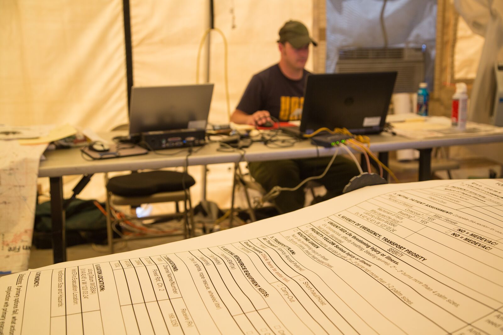
Codes are the mnemonics these jobs are actually ordered by on an incident. If you say “we need a GISS” on a fire, everyone knows what you mean.
Long Term Fire Analyst
PlanningThe figure above, for real. “Provides probabilistic and deterministic information on long-term fire advancement, fire behavior, and spread direction.” Reports to the Situation Unit Leader or Planning Section Chief; may supervise other LTANs, RAWS technicians, or Technical Specialists.
Fire Behavior Analyst
PlanningThe short horizon: what will this fire do today and tomorrow, in time for the morning briefing. The work is “collecting weather, fuels, and other relevant localized data to develop strategic and tactical fire behavior information, predict fire growth, and interpret fire characteristics.” Reports to the Situation Unit Leader or Planning Section Chief, and may provide leadership for Incident Meteorologists, other FBANs, Fire Effects Monitors, Air Resource Advisors and RAWS technicians.
Geographic Information System Specialist
Planning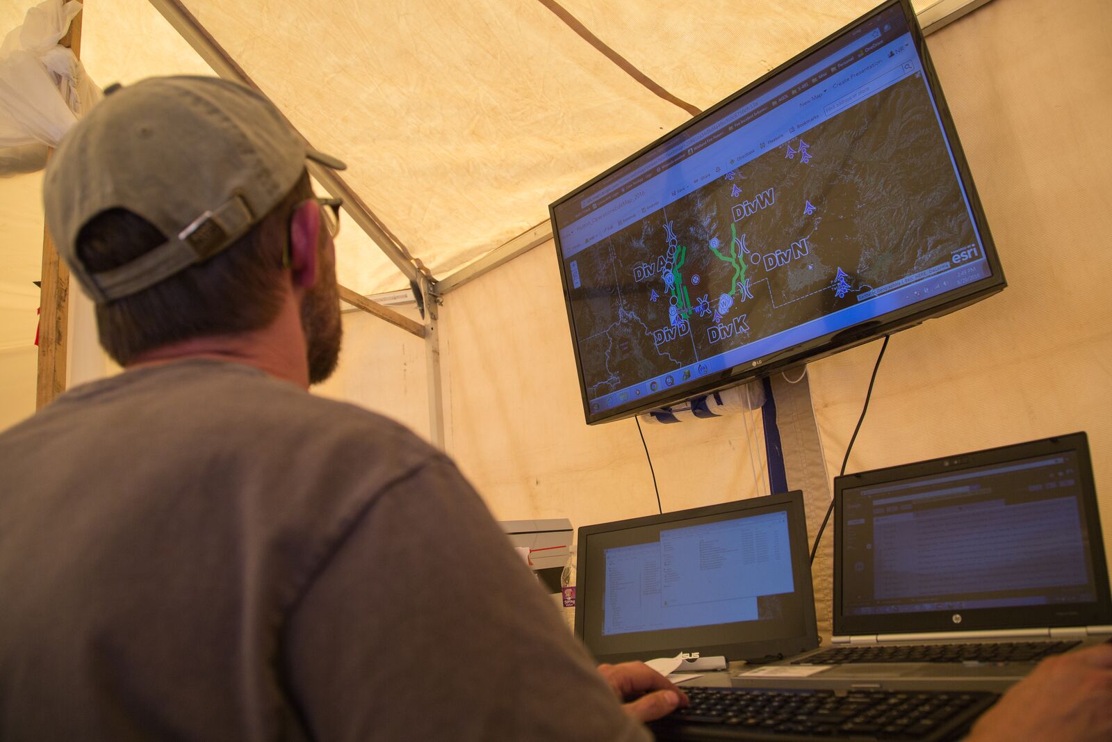
The incident's mapmaker: “responsible for providing timely and accurate spatial information about the incident to be used by all facets of the Incident Management Team and the national coordination system.” Every map in the briefing package, every perimeter, every progression map showing what the fire did overnight — right, and done before the briefing. Reports to the Situation Unit Leader.
oneway tag has four states, not two — “yes” (3,717 ways), “no” (110),
blank (312 nobody tagged), and “-1” (2 ways that run backwards from how the line is
drawn). That gap between what the data says and what the world is is the GISS's daily problem.Situation Unit Leader
PlanningThe data-fusion job, and the one the analysts report to. “Responsible for overseeing map production, and for fire behavior, fire weather, and incident status inputs.” Infrared imagery, field observers, weather feeds, GIS layers, model output — many sources, different formats, different reliability, arriving at different times — and by the briefing there is one picture, and it is the true one. Supervises “any configuration of” FBAN, LTAN, FOBS, IRIN and GISS. Reports to the Planning Section Chief.
Infrared Interpreter
Planning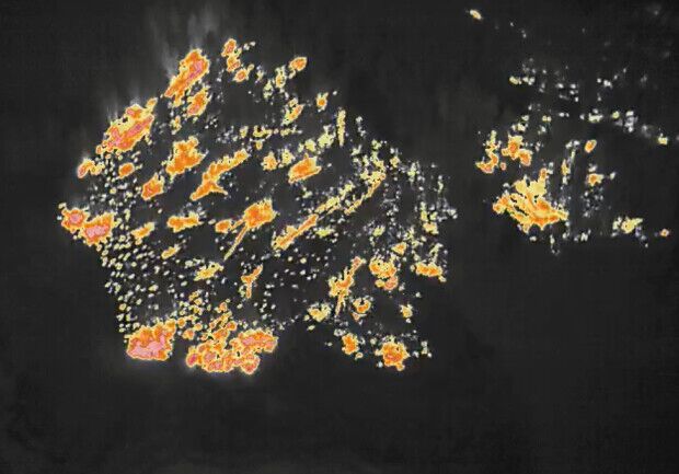
Finds the heat. Fires are flown at night, and the imagery comes back to someone who has to say where the fire actually is — “interpreting infrared (IR) imagery from National Infrared Operations (NIROPS) sensors to determine the heat perimeter of fires.” The output is real files people use by morning: “GIS-ready files, GIS layers, geo-referenced PDF maps, KMZs, and logs.”
Look at the scan. NIFC describes the job better than we could: a trained interpreter “can take a thermal image of splotches, wiggles, and dots and locate hotspots, hand lines, dozer lines, and rocks, to say nothing of obvious terrain features like roads, streams, ridges, and buildings, with extreme accuracy.”
The duties list is a computer-vision syllabus. “Identify heat perimeter of fire(s), as well as areas of intense, scattered, and isolated heat.” And then the part every student who has debugged a pipeline will recognise: “Review infrared imagery for issues, including incomplete file transfer, ortho-rectification, false positives, coverage, and image quality.”
The IRIN “works remotely and often independently” but reports to the Situation Unit Leader — or, if none is assigned, the Planning Section Chief.
Unmanned Aircraft Systems, Data Specialist
Air Operations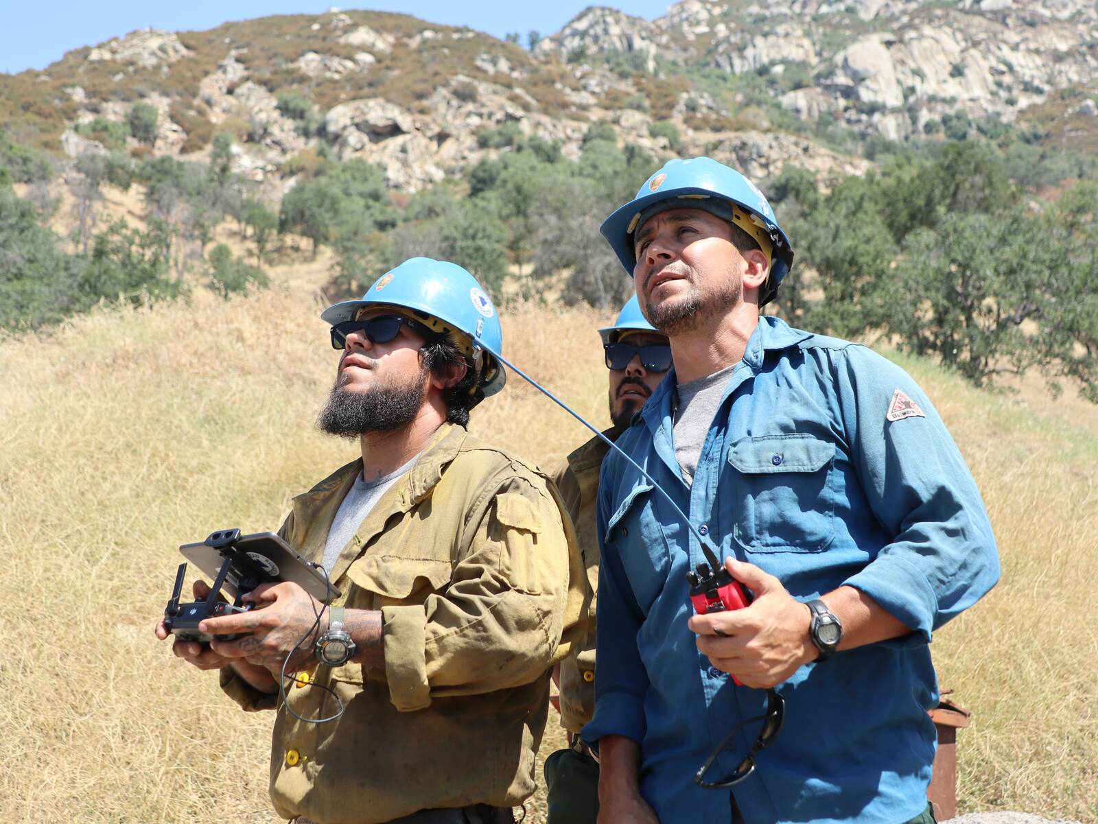
The drone job — and read NWCG's own description closely, because the word it uses matters: the UASD “manages, synthesizes, and disseminates intelligence collected by agency and contracted unmanned aircraft systems (UAS) for wildland fire incidents,” to “provide tactical and strategic information for incident command teams.” It works alongside a UAS Pilot or for a UAS Manager, and it sits in Air Operations, not Planning — the imagery work on a fire is not all in one place on the org chart.
Air Tactical Group Supervisor
Air Operations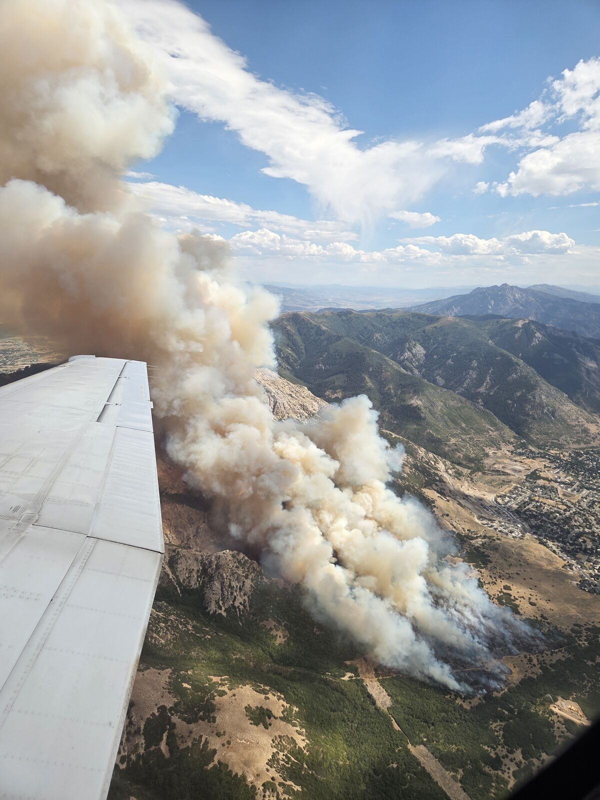
Orbits above the fire and runs the airspace. The ATGS “coordinates incident airspace, manages incident air traffic, and is the link between ground personnel and incident aircraft” — “an airborne firefighter who coordinates, assigns, and evaluates the use of aerial resources in support of incident objectives.” When they're activated, the ATGS supervises the Leadplane Pilot, the Aerial Supervision Module and the Helicopter Coordinator.
Reports to the Incident Commander on initial attack; to the Operations Section Chief or Air Operations Branch Director on bigger incidents.
Fire Effects Monitor
Planning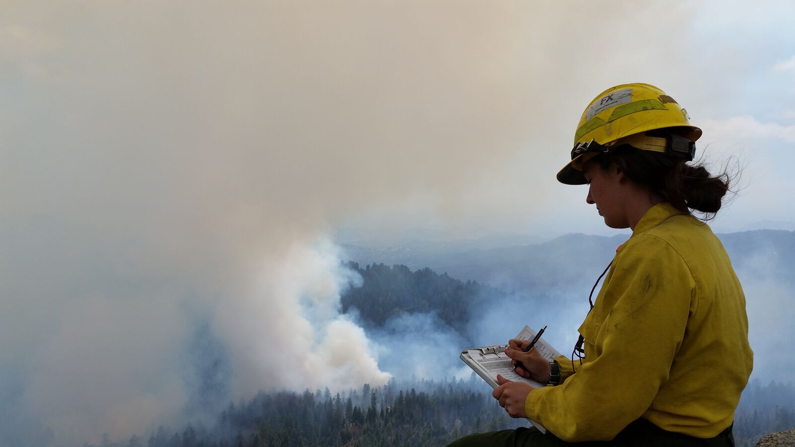
Ground truth, collected by a human being standing in it. The FEMO collects “incident status information from personal observations at the incident” — “fire perimeter location, onsite weather, fire behavior, fuel conditions, smoke, and fire effects information needed to assess firefighter safety and whether the fire is achieving established incident objectives.”
Public Information Officer, Technician
Command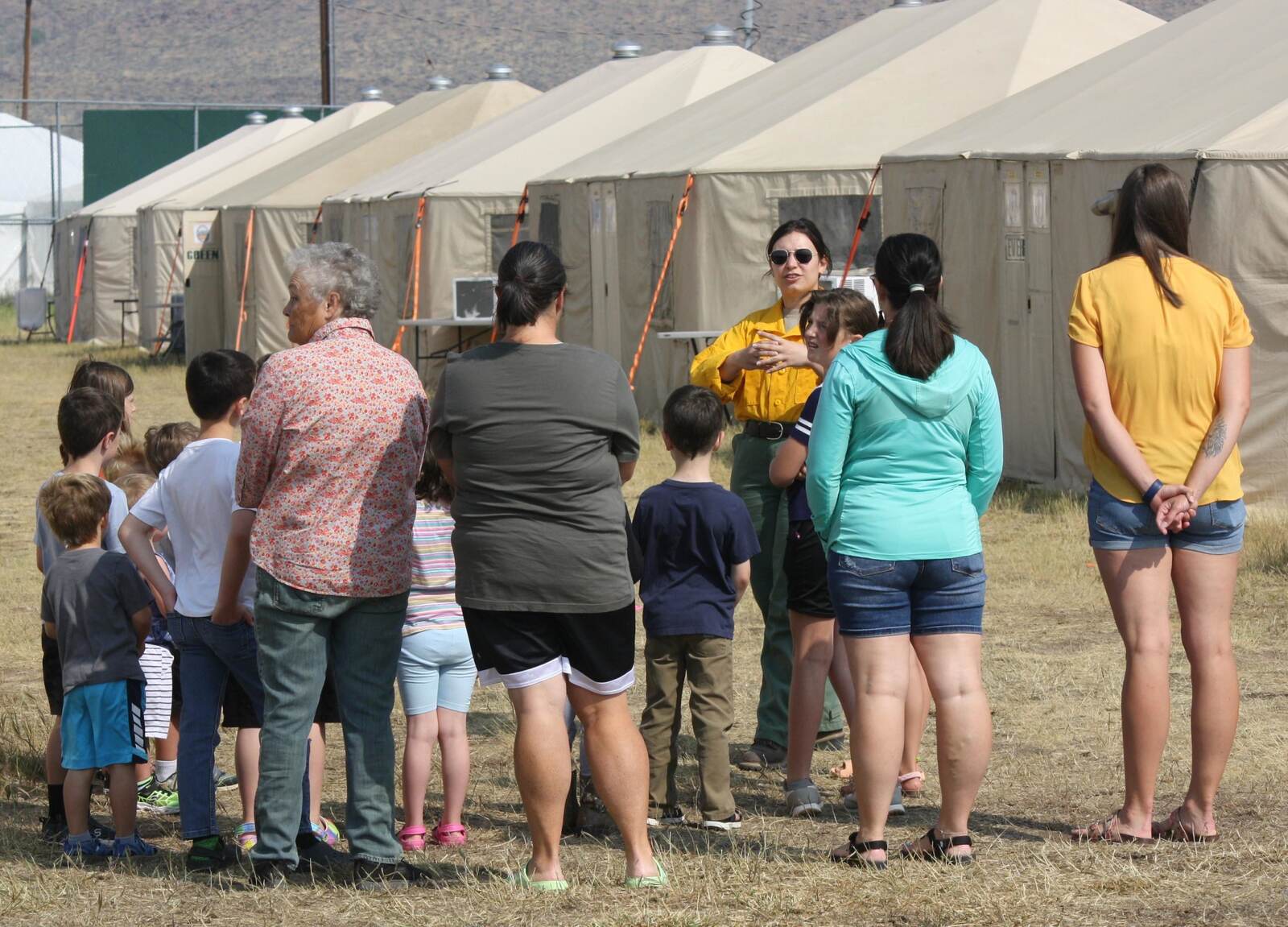
The person who tells the public the truth while it is still happening. A PIO “participates in the collection and dissemination of incident information and may be the first public point of contact” — information centres, community engagement, media. On a large incident the PIOT reports to the lead Public Information Officer as part of the Command Staff.
Burned Area Emergency Response
Post-fire · a program, not an ICS code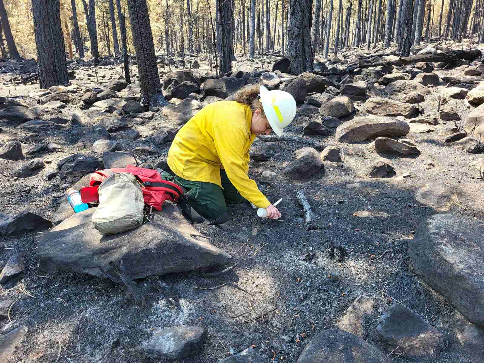
The job most people don't know exists. When the fire is out, the hazard isn't: a burned watershed sheds water instead of absorbing it, and the next storm can put a debris flow through a town that the fire never touched. BAER teams “rapidly evaluate the burned area and prescribe emergency stabilization treatments” — to “minimize threats to life or property resulting from the effects of a fire.”
They assess “presence and extent of water-repellent soils,” “debris-prone areas and downstream effects,” “potential for increased erosion or sedimentation,” and how much of each watershed burned at high severity. The assessment “usually begins before the wildfire has been fully contained,” and emergency stabilization happens within one year of containment.
A BAER assessment team is a science team. Its named roles include BAER Hydrologist, Engineer, Soil Scientist, Geologist, Botanist, Biologist, Forester — and BAER GIS Specialist.
“Infrared Interpreter” is a fossil
“Infrared Interpreter is so limiting and legacy. Imagery Intel Analyst is what that should morph to.”
He is pointing at something structural. Look at how the catalog names these jobs: Infrared Interpreter. UAS Data Specialist. The names are sensors. That taxonomy is a fossil from when the only imagery on a fire was an infrared line-scan from a fixed-wing aircraft at night — the NIROPS aircraft are a Citation and a King Air that has been flying since the mid-1980s — so naming the job after the sensor told you everything you needed to know.
It doesn't any more. Now it's drones, satellites, multispectral, real-time video. And the analytic work is identical across all of them:
- Detect — find the thing in the frame.
- Classify — decide what it is.
- Geolocate — put it on the map, in real coordinates.
- Track change over time — what moved since the last pass?
- Fuse — reconcile it with the other sources.
- Produce something a decision-maker acts on — before the briefing.
That is imagery intelligence. The sensor is an implementation detail.
And here is the thing that settles it — the catalog has already half-admitted this in its own words. Read the two descriptions side by side. The drone job “manages, synthesizes, and disseminates intelligence.” The infrared job interprets. Same verbs, same product, one of them written thirty years later. The newer job got the modern word because it was named in the drone era; the older one is still carrying the name it was given when it was the only game in town.
IRIN · Infrared Interpreter — Planning
UASD · Unmanned Aircraft Systems, Data
Specialist — Air Operations
Different codes, different functional areas, different task
books, different courses — for the same analytic work on different hardware. One of them is
even called intelligence already.
Imagery Intel Analyst
Detect, classify, geolocate, track, fuse. Infrared, drone,
satellite, multispectral, video — because the algorithms don't care where the pixels came
from.
There's a second tell, buried in the course lists. The drone job's supporting training includes S-341 — the GIS course the GISS takes — and S-443, the infrared course. The catalog is already routing one person through all three sensors. It just hasn't given that person a name yet.
Don't train for infrared. Train for imagery analysis. The skill transfers across sensors, and the job titles will consolidate.
Which is the most useful thing on this page for a student, because it tells you what to actually learn. You built this at the Institute this week. The laser lab — thresholding to find the bright thing, blob detection to decide what counts as one object, tracking it across frames — is imagery intelligence at classroom scale. Point that at an infrared frame instead of a webcam and the code barely changes. That is the whole point.
The same section, a different hazard
ICS is all-hazard — “it is used for all kinds of incidents” — so this same structure stands up on a flood or a chemical release. But there is no flood equivalent of FBAN or LTAN with its own code and course list. Instead, ICS reaches for a Technical Specialist, and FEMA is blunt about what that takes: “No specific qualifications are prescribed, as technical specialists normally perform the same duties during an incident that they perform in their everyday jobs.”
So a hydrologist gets on an incident by already being a hydrologist. There is no shortcut course, which means the road starts where you are: become someone who models water, or air, or contaminants — and then be the person in the region who can do it when the river comes up.